
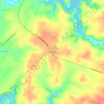
McDaniels topographic map
Interactive map
Click on the map to display elevation.
About this map
Name: McDaniels topographic map, elevation, terrain.
Average elevation: 620 ft
Minimum elevation: 486 ft
Maximum elevation: 735 ft
Other topographic maps
Click on a map to view its topography, its elevation and its terrain.
Harned
United States > Kentucky > Breckinridge County
Harned, Breckinridge County, Kentucky, 40144, United States
Average elevation: 738 ft
Garfield
United States > Kentucky > Breckinridge County
Garfield, Breckinridge County, Kentucky, 40144, United States
Average elevation: 755 ft
Custer
United States > Kentucky > Breckinridge County
Custer, Breckinridge County, Kentucky, 40115, United States
Average elevation: 778 ft