
Еловский район topographic map
Interactive map
Click on the map to display elevation.
About this map
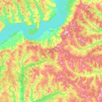
Name: Еловский район topographic map, elevation, terrain.
Average elevation: 558 ft
Minimum elevation: 266 ft
Maximum elevation: 971 ft
Other topographic maps
Click on a map to view its topography, its elevation and its terrain.
Лемба
Russie > Kraï de Perm > Чердынский городской округ
Лемба, Чердынский городской округ, Kraï de Perm, District fédéral de la Volga, Russie
Average elevation: 505 ft
Серебрянка
Russie > Kraï de Perm > Серебрянка
Серебрянка, Гайнский район, Коми-Пермяцкий округ, Kraï de Perm, District fédéral de la Volga, 619674, Russie
Average elevation: 479 ft