
Thank you for supporting this site ❤️
Make a donation
Make a donation
Gear up for your next adventure:
As an Amazon Associate, this site earns from qualifying purchases at no extra cost to you.
Gulistan e Johar topographic map
Click on the map to display elevation.
Thank you for supporting this site ❤️
Make a donation
Make a donation
Gear up for your next adventure:
As an Amazon Associate, this site earns from qualifying purchases at no extra cost to you.
About this map
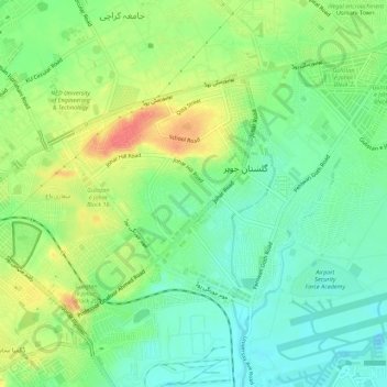
Name: Gulistan e Johar topographic map, elevation, terrain.
Location: Gulistan e Johar, Gulshan Town, Sindh, 75300, Pakistan (24.90216 67.10806 24.93918 67.16320)
Average elevation: 128 ft
Minimum elevation: 49 ft
Maximum elevation: 246 ft
Thank you for supporting this site ❤️
Make a donation
Make a donation
Gear up for your next adventure:
As an Amazon Associate, this site earns from qualifying purchases at no extra cost to you.