
Atenguillo topographic map
Interactive map
Click on the map to display elevation.
About this map
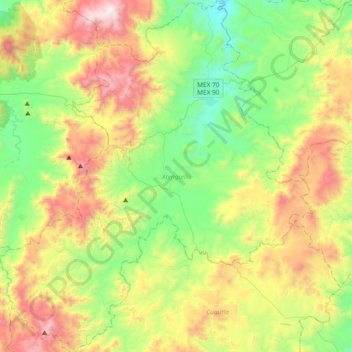
Name: Atenguillo topographic map, elevation, terrain.
Location: Atenguillo, Jalisco, México (20.16321 -104.71822 20.51530 -104.38499)
Average elevation: 5,755 ft
Minimum elevation: 3,993 ft
Maximum elevation: 8,793 ft
Other topographic maps
Click on a map to view its topography, its elevation and its terrain.
Los Volcanes
México > Jalisco > Atenguillo > Los Volcanes
Los Volcanes, Atenguillo, Jalisco, 48130, México
Average elevation: 4,931 ft