
Thank you for supporting this site ❤️
Make a donation
Make a donation
Gear up for your next adventure:
As an Amazon Associate, this site earns from qualifying purchases at no extra cost to you.
Hecho topographic map
Click on the map to display elevation.
Thank you for supporting this site ❤️
Make a donation
Make a donation
Gear up for your next adventure:
As an Amazon Associate, this site earns from qualifying purchases at no extra cost to you.
About this map
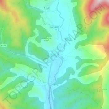
Name: Hecho topographic map, elevation, terrain.
Location: Hecho, Valle de Hecho, Jacetania, Huesca, Aragon, 22720, Spain (42.71839 -0.77032 42.75839 -0.73032)
Average elevation: 3,173 ft
Minimum elevation: 2,572 ft
Maximum elevation: 4,734 ft
Thank you for supporting this site ❤️
Make a donation
Make a donation
Gear up for your next adventure:
As an Amazon Associate, this site earns from qualifying purchases at no extra cost to you.