
La Grange Dieu topographic map
Interactive map
Click on the map to display elevation.
About this map
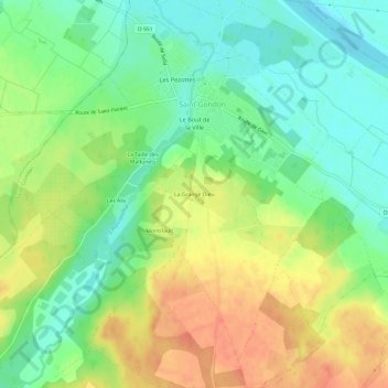
Name: La Grange Dieu topographic map, elevation, terrain.
Average elevation: 459 ft
Minimum elevation: 384 ft
Maximum elevation: 548 ft
Other topographic maps
Click on a map to view its topography, its elevation and its terrain.
La Fontaine Blanche
France > Centre-Val de Loire > Loiret > Saint-Gondon
La Fontaine Blanche, Saint-Gondon, Montargis, Loiret, Centre-Val de Loire, France métropolitaine, 45500, France
Average elevation: 440 ft