
Thank you for supporting this site ❤️
Make a donation
Make a donation
Gear up for your next adventure:
As an Amazon Associate, this site earns from qualifying purchases at no extra cost to you.
新宅村 topographic map
Click on the map to display elevation.
Thank you for supporting this site ❤️
Make a donation
Make a donation
Gear up for your next adventure:
As an Amazon Associate, this site earns from qualifying purchases at no extra cost to you.
About this map
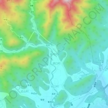
Name: 新宅村 topographic map, elevation, terrain.
Location: 新宅村, 衢州市, 浙江省, 中国 (29.06597 118.82231 29.10597 118.86231)
Average elevation: 817 ft
Minimum elevation: 331 ft
Maximum elevation: 2,228 ft
Thank you for supporting this site ❤️
Make a donation
Make a donation
Gear up for your next adventure:
As an Amazon Associate, this site earns from qualifying purchases at no extra cost to you.