
Thank you for supporting this site ❤️
Make a donation
Make a donation
Gear up for your next adventure:
As an Amazon Associate, this site earns from qualifying purchases at no extra cost to you.
Ottweiler topographic map
Click on the map to display elevation.
Thank you for supporting this site ❤️
Make a donation
Make a donation
Gear up for your next adventure:
As an Amazon Associate, this site earns from qualifying purchases at no extra cost to you.
About this map
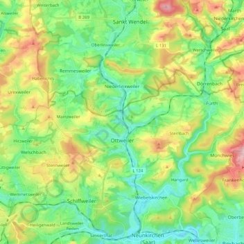
Name: Ottweiler topographic map, elevation, terrain.
Location: Ottweiler, Landkreis Neunkirchen, Saarland, 66564, Germany (49.38435 7.09076 49.44109 7.29285)
Average elevation: 1,079 ft
Minimum elevation: 774 ft
Maximum elevation: 1,683 ft
Thank you for supporting this site ❤️
Make a donation
Make a donation
Gear up for your next adventure:
As an Amazon Associate, this site earns from qualifying purchases at no extra cost to you.