
Abasolo topographic map
Interactive map
Click on the map to display elevation.
About this map
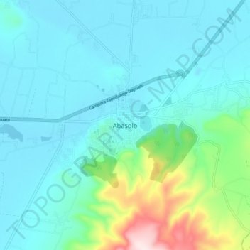
Name: Abasolo topographic map, elevation, terrain.
Location: Abasolo, Guanajuato, México (20.40926 -101.56915 20.48926 -101.48915)
Average elevation: 5,817 ft
Minimum elevation: 5,528 ft
Maximum elevation: 7,218 ft