
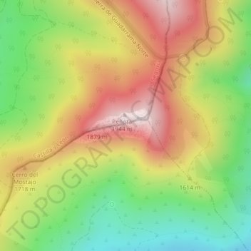
La Peñota topographic map
Interactive map
Click on the map to display elevation.
About this map
Name: La Peñota topographic map, elevation, terrain.
Average elevation: 5,230 ft
Minimum elevation: 4,219 ft
Maximum elevation: 6,302 ft
Other topographic maps
Click on a map to view its topography, its elevation and its terrain.
Los Molinos
España > Comunidad de Madrid > Los Molinos
Los Molinos, Cuenca del Guadarrama, Comunidad de Madrid, 28460, España
Average elevation: 3,579 ft