
Walferdange topographic map
Interactive map
Click on the map to display elevation.
About this map
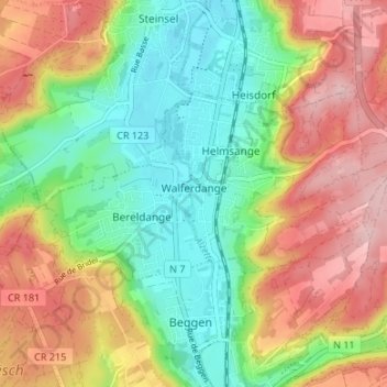
Name: Walferdange topographic map, elevation, terrain.
Location: Walferdange, Canton Luxembourg, Luxembourg (49.64627 6.09814 49.66940 6.16503)
Average elevation: 1,014 ft
Minimum elevation: 735 ft
Maximum elevation: 1,358 ft