La Hutte aux-Renard topographic map
Interactive map
Click on the map to display elevation.
About this map
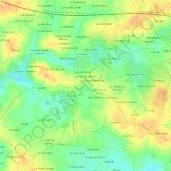
Name: La Hutte aux-Renard topographic map, elevation, terrain.
Average elevation: 200 ft
Minimum elevation: 141 ft
Maximum elevation: 253 ft

Click on the map to display elevation.
Name: La Hutte aux-Renard topographic map, elevation, terrain.
Average elevation: 200 ft
Minimum elevation: 141 ft
Maximum elevation: 253 ft