
La Grande Planche topographic map
Interactive map
Click on the map to display elevation.
About this map
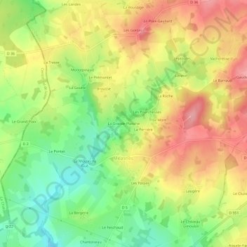
Name: La Grande Planche topographic map, elevation, terrain.
Average elevation: 1,181 ft
Minimum elevation: 991 ft
Maximum elevation: 1,362 ft
Other topographic maps
Click on a map to view its topography, its elevation and its terrain.
Le Barraud
France > Nouvelle-Aquitaine > Creuse > Méasnes
Le Barraud, Méasnes, Guéret, Creuse, Nouvelle-Aquitaine, France métropolitaine, 23360, France
Average elevation: 1,280 ft