Geolocate

Adelphi topographic map

Click on the map to display elevation.

About this map

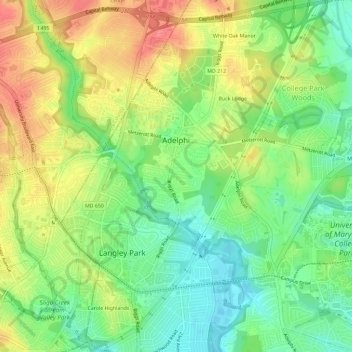
Name: Adelphi topographic map, elevation, terrain.

Location: Adelphi, Prince George's County, Maryland, United States (38.97587 -76.98371 39.02104 -76.93793)

Average elevation: 184 ft

Minimum elevation: 56 ft

Maximum elevation: 358 ft

Prince George's County trails, hiking, mountain biking, running and outdoor activities

Other topographic maps

Click on a map to view its topography, its elevation and its terrain.

Gear up for your next adventure:

🚁Photography Drones - Capture stunning aerial views of landforms and topography
🧦Hiking Socks - Comfortable socks to prevent blisters on long hikes
🛌Ultralight Sleeping Bags - Compact down bags for cold nights in the wilderness
🔦Compact Flashlight - Reliable flashlight for emergencies
🔭Telescopic Hiking Pole - Adjustable pole for hiking stability

As an Amazon Associate, this site earns from qualifying purchases at no extra cost to you.