Geolocate

Mollare topographic map

Click on the map to display elevation.

About this map

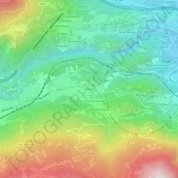
Name: Mollare topographic map, elevation, terrain.

Location: Mollare, Gravere, Torino, Piedmont, 10059, Italy (45.10667 6.99744 45.14667 7.03744)

Average elevation: 2,900 ft

Minimum elevation: 1,650 ft

Maximum elevation: 5,200 ft

Gear up for your next adventure:

🪶Paracord Bracelet - Survival bracelet with built‑in tools
📦Dry Bags Set - Waterproof storage for electronics and clothes
🦶Carbon Trekking Poles - Reduce knee impact on steep descents with ultra-light poles
🔦Compact Flashlight - Reliable flashlight for emergencies
🪑Portable Camp Table - Compact table for campsite meals

As an Amazon Associate, this site earns from qualifying purchases at no extra cost to you.