
Étang de la Garenne topographic map
Interactive map
Click on the map to display elevation.
About this map
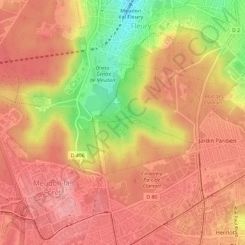
Name: Étang de la Garenne topographic map, elevation, terrain.
Average elevation: 499 ft
Minimum elevation: 256 ft
Maximum elevation: 614 ft
Other topographic maps
Click on a map to view its topography, its elevation and its terrain.
Le Petit Clamart
France > Île-de-France > Hauts-de-Seine > Clamart
Le Petit Clamart, Clamart, Antony, Hauts-de-Seine, Île-de-France, France métropolitaine, 92140, France
Average elevation: 535 ft