
Apulia topographic map
Interactive map
Click on the map to display elevation.
About this map
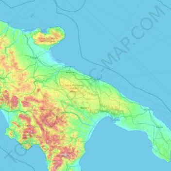
Name: Apulia topographic map, elevation, terrain.
Location: Apulia, Italy (39.78959 14.93497 42.22648 18.52051)
Average elevation: 548 ft
Minimum elevation: -13 ft
Maximum elevation: 7,057 ft
Other topographic maps
Click on a map to view its topography, its elevation and its terrain.