
联财镇 topographic map
Interactive map
Click on the map to display elevation.
About this map
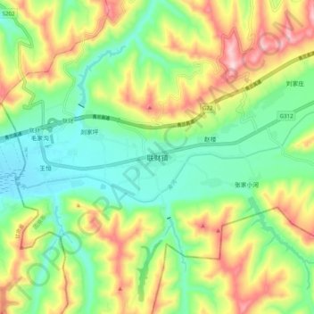
Name: 联财镇 topographic map, elevation, terrain.
Location: 联财镇, 隆德县, 固原市, 宁夏回族自治区, 中国 (35.52118 105.82101 35.60118 105.90101)
Average elevation: 6,079 ft
Minimum elevation: 5,646 ft
Maximum elevation: 6,791 ft
Other topographic maps
Click on a map to view its topography, its elevation and its terrain.