
Uikhoven topographic map
Interactive map
Click on the map to display elevation.
About this map
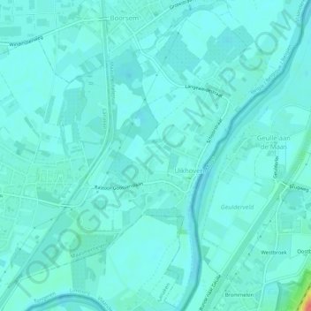
Name: Uikhoven topographic map, elevation, terrain.
Average elevation: 138 ft
Minimum elevation: 112 ft
Maximum elevation: 305 ft
Other topographic maps
Click on a map to view its topography, its elevation and its terrain.
Vucht
België > Vlaanderen > Maasmechelen
Vucht, Maasmechelen, Tongeren, Limburg, Vlaanderen, België
Average elevation: 154 ft