Geolocate

Cellio topographic map

Click on the map to display elevation.

About this map

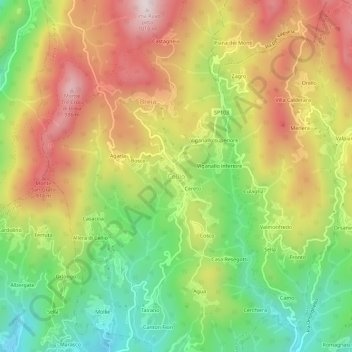
Name: Cellio topographic map, elevation, terrain.

Location: Cellio, Cellio con Breia, Vercelli, Piedmont, 13024, Italy (45.73607 8.29162 45.77607 8.33162)

Average elevation: 2,267 ft

Minimum elevation: 1,319 ft

Maximum elevation: 3,294 ft

Gear up for your next adventure:

🧣Merino Neck Gaiters - Multi-functional headwear for wind and sun protection
🛰️Handheld GPS Units - Professional satellite navigators for precise backcountry mapping
📷Action Cameras - Rugged cameras to document your journeys across rugged terrain
Backpacking Tent - Lightweight and durable tent for multi‑day hikes
🪶Thermal Camp Blanket - Extra warmth for cold nights

As an Amazon Associate, this site earns from qualifying purchases at no extra cost to you.