
L'Ami topographic map
Interactive map
Click on the map to display elevation.
About this map
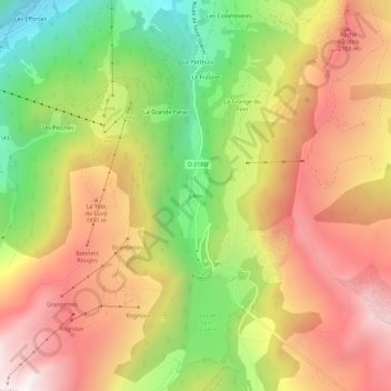
Name: L'Ami topographic map, elevation, terrain.
Average elevation: 5,774 ft
Minimum elevation: 3,570 ft
Maximum elevation: 7,733 ft
Other topographic maps
Click on a map to view its topography, its elevation and its terrain.
Pierra Menta
France > Auvergne-Rhône-Alpes > Savoie > Beaufort
Pierra Menta, Beaufort, Albertville, Savoie, Auvergne-Rhône-Alpes, France métropolitaine, 73270, France
Average elevation: 7,625 ft