
Terril de l'Héribus topographic map
Interactive map
Click on the map to display elevation.
About this map
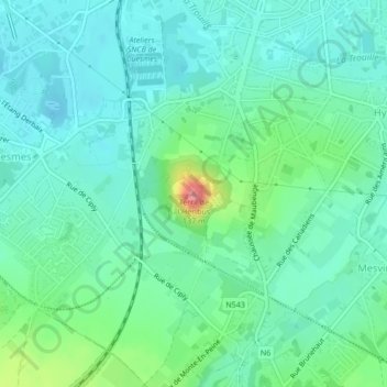
Name: Terril de l'Héribus topographic map, elevation, terrain.
Location: Terril de l'Héribus, Mons, Hainaut, Wallonie, 7024, Belgique (50.43352 3.94081 50.43362 3.94091)
Average elevation: 144 ft
Minimum elevation: 69 ft
Maximum elevation: 394 ft
Other topographic maps
Click on a map to view its topography, its elevation and its terrain.
Villers-Saint-Ghislain
Belgique > Hainaut > Mons > Mons
Villers-Saint-Ghislain, Mons, Hainaut, Wallonie, 7031, Belgique
Average elevation: 243 ft
Saint-Denis
Belgique > Hainaut > Mons > Mons
Saint-Denis, Mons, Hainaut, Wallonie, 7034, Belgique
Average elevation: 262 ft
Harmignies
Belgique > Hainaut > Mons > Mons > Harmignies
Harmignies, Mons, Hainaut, Wallonie, 7022, Belgique
Average elevation: 213 ft