
Refuge du Carrelet topographic map
Interactive map
Click on the map to display elevation.
About this map
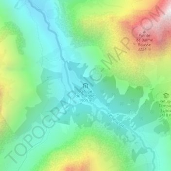
Name: Refuge du Carrelet topographic map, elevation, terrain.
Average elevation: 7,510 ft
Minimum elevation: 5,988 ft
Maximum elevation: 10,971 ft
Other topographic maps
Click on a map to view its topography, its elevation and its terrain.
Chalet Alpin de la Bérarde
France > Auvergne-Rhône-Alpes > Saint-Christophe-en-Oisans > La Bérarde
Chalet Alpin de la Bérarde, D 530, La Bérarde, Saint-Christophe-en-Oisans, Auvergne-Rhône-Alpes, France métropolitaine, 38520, France
Average elevation: 6,972 ft