Geolocate

Regensburg topographic map

Click on the map to display elevation.

About this map

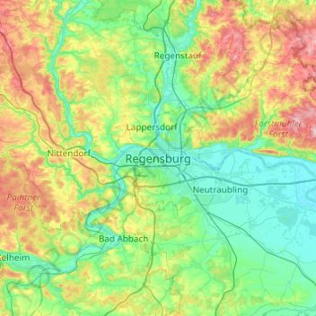
Name: Regensburg topographic map, elevation, terrain.

Location: Regensburg, Upper Palatinate, Bavaria, 93047, Germany (48.85953 11.93749 49.17953 12.25749)

Average elevation: 1,332 ft

Minimum elevation: 1,060 ft

Maximum elevation: 2,021 ft

Gear up for your next adventure:

🩹Survival Bandages - High‑quality bandages for emergencies
🪶LED Camping Lantern - Bright lantern for camp lighting
🚁Photography Drones - Capture stunning aerial views of landforms and topography
🌲Outdoor Survival Books - Best books on survival skills
🌡️Portable Weather Meter - Track weather conditions on the trail

As an Amazon Associate, this site earns from qualifying purchases at no extra cost to you.