
Witten topographic map
Interactive map
Click on the map to display elevation.
About this map
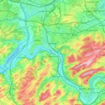
Name: Witten topographic map, elevation, terrain.
Average elevation: 449 ft
Minimum elevation: 223 ft
Maximum elevation: 896 ft
Other topographic maps
Click on a map to view its topography, its elevation and its terrain.
Steinberg
Allemagne > Rhénanie-du-Nord-Westphalie > Ennepe-Ruhr-Kreis > Witten
Steinberg, Witten, Ennepe-Ruhr-Kreis, Rhénanie-du-Nord-Westphalie, 58454, Allemagne
Average elevation: 433 ft
Hattingen
Allemagne > Rhénanie-du-Nord-Westphalie > Ennepe-Ruhr-Kreis
Hattingen, Ennepe-Ruhr-Kreis, Rhénanie-du-Nord-Westphalie, Allemagne
Average elevation: 551 ft