
Krüden topographic map
Interactive map
Click on the map to display elevation.
About this map
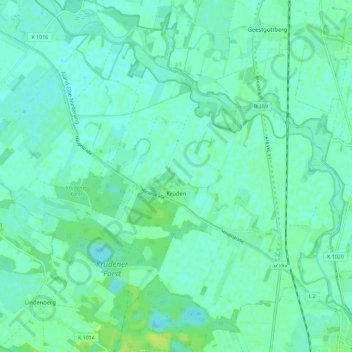
Name: Krüden topographic map, elevation, terrain.
Location: Krüden, Aland, Seehausen, Stendal, Sachsen-Anhalt, Deutschland (52.89691 11.63901 52.95601 11.75404)
Average elevation: 72 ft
Minimum elevation: 56 ft
Maximum elevation: 98 ft