
南圍村 topographic map
Interactive map
Click on the map to display elevation.
About this map
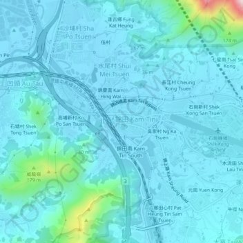
Name: 南圍村 topographic map, elevation, terrain.
Location: 南圍村, 錦田市, 元朗區, 新界, 香港, 中国 (22.41871 114.04303 22.45871 114.08303)
Average elevation: 125 ft
Minimum elevation: -16 ft
Maximum elevation: 1,329 ft
Other topographic maps
Click on a map to view its topography, its elevation and its terrain.