
Lewisburg topographic map
Interactive map
Click on the map to display elevation.
About this map
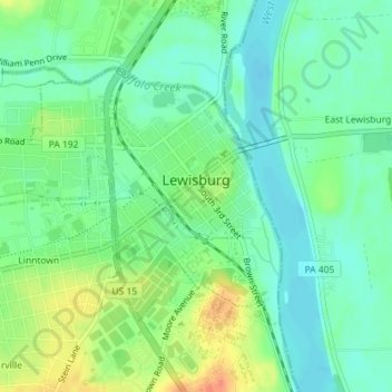
Name: Lewisburg topographic map, elevation, terrain.
Location: Lewisburg, Union County, Pennsylvania, USA (40.95440 -76.90879 40.97183 -76.87714)
Average elevation: 466 ft
Minimum elevation: 413 ft
Maximum elevation: 561 ft