
美援新村 topographic map
Interactive map
Click on the map to display elevation.
About this map
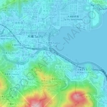
Name: 美援新村 topographic map, elevation, terrain.
Location: 美援新村, 下黃宜坳村, 大埔區, 新界, 香港, 中国 (22.42290 114.15853 22.46290 114.19853)
Average elevation: 217 ft
Minimum elevation: -26 ft
Maximum elevation: 1,355 ft
Other topographic maps
Click on a map to view its topography, its elevation and its terrain.