
小罗家坪 topographic map
Interactive map
Click on the map to display elevation.
About this map
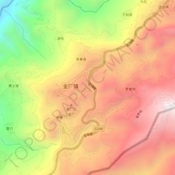
Name: 小罗家坪 topographic map, elevation, terrain.
Location: 小罗家坪, 金厂镇, 马关县, 文山壮族苗族自治州, 云南省, 中国 (22.75520 104.44317 22.79520 104.48317)
Average elevation: 4,619 ft
Minimum elevation: 2,110 ft
Maximum elevation: 6,447 ft
Other topographic maps
Click on a map to view its topography, its elevation and its terrain.