
Culebra Island topographic map
Interactive map
Click on the map to display elevation.
About this map
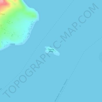
Name: Culebra Island topographic map, elevation, terrain.
Average elevation: 20 ft
Minimum elevation: 0 ft
Maximum elevation: 456 ft
Other topographic maps
Click on a map to view its topography, its elevation and its terrain.
San Pedro
Philippines > Batangas > Tingloy
San Pedro, Tingloy, Batangas, Calabarzon, Philippines
Average elevation: 358 ft
Sombrero Island
Philippines > Batangas > Tingloy
Sombrero Island, Tingloy, Batangas, Calabarzon, 4203, Philippines
Average elevation: 0 ft
San Isidro
Philippines > Batangas > Tingloy > San Isidro
San Isidro, Tingloy, Batangas, Calabarzon, Philippines
Average elevation: 364 ft
Maricaban Island
Philippines > Batangas > Tingloy
Maricaban Island, Tingloy, Batangas, Calabarzon, 4203, Philippines
Average elevation: 98 ft