
Pragnapur topographic map
Interactive map
Click on the map to display elevation.
About this map
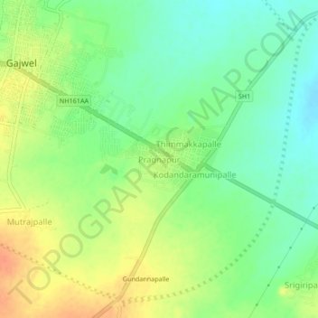
Name: Pragnapur topographic map, elevation, terrain.
Average elevation: 1,854 ft
Minimum elevation: 1,791 ft
Maximum elevation: 1,932 ft
Other topographic maps
Click on a map to view its topography, its elevation and its terrain.
Gajwel
India > Telangana > Gajwel mandal
Gajwel, Gajwel mandal, Siddipet District, Telangana, 502278, India
Average elevation: 1,864 ft