
Gifhorn topographic map
Interactive map
Click on the map to display elevation.
About this map
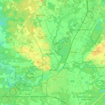
Name: Gifhorn topographic map, elevation, terrain.
Location: Gifhorn, Nedersaksen, 38518, Duitsland (52.44723 10.42421 52.56960 10.62710)
Average elevation: 187 ft
Minimum elevation: 141 ft
Maximum elevation: 266 ft