
Guadalupe topographic map
Interactive map
Click on the map to display elevation.
About this map
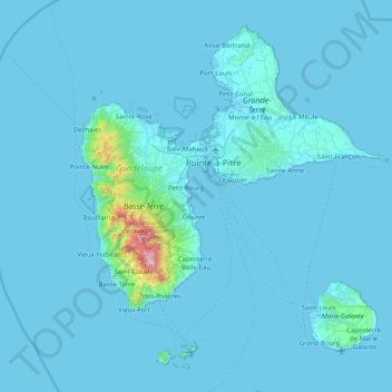
Name: Guadalupe topographic map, elevation, terrain.
Location: Guadalupe, Francia (15.83201 -61.80976 16.51452 -61.00037)
Average elevation: 121 ft
Minimum elevation: -3 ft
Maximum elevation: 4,724 ft