
Aliakmonas topographic map
Interactive map
Click on the map to display elevation.
About this map
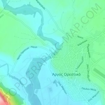
Name: Aliakmonas topographic map, elevation, terrain.
Average elevation: 2,106 ft
Minimum elevation: 2,014 ft
Maximum elevation: 2,556 ft
Other topographic maps
Click on a map to view its topography, its elevation and its terrain.
Pournari-I-Stausee
Griechenland > Epirus - Westmakedonien > Ρουμάνια
Pournari-I-Stausee, Προς Μέγα Κάμπο, Ρουμάνια, Δήμος Αρταίων, Regionalbezirk Arta, Region Epirus, Epirus - Westmakedonien, Griechenland
Average elevation: 1,109 ft