
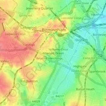
Attwood Green topographic map
Interactive map
Click on the map to display elevation.
About this map
Name: Attwood Green topographic map, elevation, terrain.
Average elevation: 430 ft
Minimum elevation: 325 ft
Maximum elevation: 551 ft
Other topographic maps
Click on a map to view its topography, its elevation and its terrain.
Sparkbrook
United Kingdom > England > Birmingham
Sparkbrook, Birmingham, West Midlands Combined Authority, England, B11 1AG, United Kingdom
Average elevation: 407 ft
Birmingham
United Kingdom > England > Birmingham
Birmingham, West Midlands Combined Authority, England, B2 4AJ, United Kingdom
Average elevation: 427 ft
Metchley
United Kingdom > England > Birmingham
Metchley, Birmingham, West Midlands Combined Authority, England, B15 2WB, United Kingdom
Average elevation: 492 ft
Balsall Heath
United Kingdom > England > Birmingham
Balsall Heath, Birmingham, West Midlands Combined Authority, England, B12 8SY, United Kingdom
Average elevation: 423 ft
Aston
United Kingdom > England > Birmingham
Aston, Birmingham, West Midlands Combined Authority, England, B6 5PL, United Kingdom
Average elevation: 394 ft
Park Central
United Kingdom > England > Birmingham
Park Central, Birmingham, West Midlands Combined Authority, England, B15 2GE, United Kingdom
Average elevation: 436 ft
Brookvale Village
United Kingdom > England > Birmingham > Brookvale Village
Brookvale Village, Birmingham, West Midlands Combined Authority, England, B23 7YD, United Kingdom
Average elevation: 364 ft
Moor End Green
United Kingdom > England > Birmingham > Moor End Green
Moor End Green, Birmingham, West Midlands Combined Authority, West Midlands, England, B24 9DG, United Kingdom
Average elevation: 354 ft
Sutton Coldfield
United Kingdom > England > Birmingham
Sutton Coldfield, Birmingham, West Midlands Combined Authority, England, United Kingdom
Average elevation: 407 ft