
دهستان لیل topographic map
Interactive map
Click on the map to display elevation.
About this map
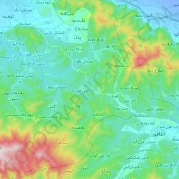
Name: دهستان لیل topographic map, elevation, terrain.
Location: دهستان لیل, بخش مرکزی, Lahijan County, Gilan Province, Iran (37.08082 49.99919 37.19557 50.09980)
Average elevation: 620 ft
Minimum elevation: -72 ft
Maximum elevation: 2,707 ft