
Os Blancos topographic map
Interactive map
Click on the map to display elevation.
About this map
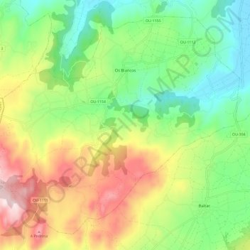
Name: Os Blancos topographic map, elevation, terrain.
Location: Os Blancos, A Limia, Ourense, Galicië, Spanje (41.94121 -7.81494 42.01631 -7.69935)
Average elevation: 2,858 ft
Minimum elevation: 2,064 ft
Maximum elevation: 4,108 ft