
Sungai Kuyoh topographic map
Interactive map
Click on the map to display elevation.
About this map
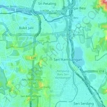
Name: Sungai Kuyoh topographic map, elevation, terrain.
Location: Sungai Kuyoh, Subang Jaya, Petaling, Selangor, 57000, Malaysia (3.00526 101.65030 3.06991 101.71058)
Average elevation: 197 ft
Minimum elevation: 75 ft
Maximum elevation: 915 ft
Other topographic maps
Click on a map to view its topography, its elevation and its terrain.
Sunway Utama
Malaysia > Selangor > Subang Jaya
Sunway Utama, Sunway City, Subang Jaya, Petaling, Selangor, Malaysia
Average elevation: 62 ft
Puchong
Malaysia > Selangor > Subang Jaya
Puchong, Subang Jaya, Petaling, Selangor, 47160, Malaysia
Average elevation: 125 ft