Geolocate

Tangob topographic map

Click on the map to display elevation.

About this map

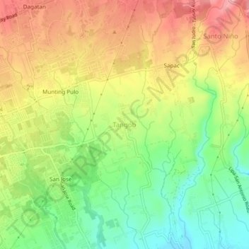
Name: Tangob topographic map, elevation, terrain.

Location: Tangob, Lipa, Batangas, Calabarzon, 4217, Philippines (13.92702 121.17646 13.96702 121.21646)

Average elevation: 965 ft

Minimum elevation: 758 ft

Maximum elevation: 1,178 ft

Other topographic maps

Click on a map to view its topography, its elevation and its terrain.

Lipa City Community Park

Philippines > Batangas > Lipa > Latag

Average elevation: 1,020 ft

Malepunyo Mountain Range

Philippines > Batangas > Lipa

Average elevation: 968 ft

Pangao

Philippines > Batangas > Lipa

Average elevation: 1,063 ft

Pinagkawitan

Philippines > Batangas > Lipa

Average elevation: 732 ft

Sabang

Philippines > Batangas > Lipa

Average elevation: 1,063 ft

Tambo

Philippines > Batangas > Lipa

Average elevation: 1,158 ft

6

Philippines > Batangas > Lipa

Average elevation: 1,027 ft

Lumbang

Philippines > Batangas > Lipa

Average elevation: 1,138 ft

Halang

Philippines > Batangas > Lipa > Halang

Average elevation: 561 ft

Pangao

Philippines > Batangas > Lipa

Average elevation: 1,063 ft

Sabang

Philippines > Batangas > Lipa

Average elevation: 1,063 ft

Gear up for your next adventure:

🧷Carabiner Set - Durable clips for gear attachment
🦶Carbon Trekking Poles - Reduce knee impact on steep descents with ultra-light poles
🧤Hiking Gloves - Protective gloves for rugged trails
🗺️NatGeo Topo Maps - High-quality waterproof printed topographic maps of US Parks
🧭Pro Hiking Compasses - High-accuracy liquid-filled compasses for topographic orientation

As an Amazon Associate, this site earns from qualifying purchases at no extra cost to you.