
Shahreza topographic map
Interactive map
Click on the map to display elevation.
About this map
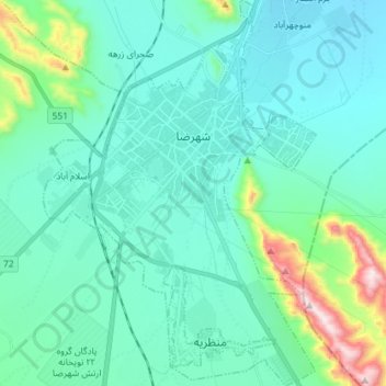
Name: Shahreza topographic map, elevation, terrain.
Average elevation: 6,240 ft
Minimum elevation: 5,823 ft
Maximum elevation: 8,448 ft
Other topographic maps
Click on a map to view its topography, its elevation and its terrain.
Shahreza
Iran > Isfahan Province > Shahreza County > دهستان دشت > Shahreza
Shahreza, دهستان دشت, Shahreza Central District, Shahreza County, Isfahan Province, 14853718, Iran
Average elevation: 6,096 ft