
Deriba Caldera topographic map
Interactive map
Click on the map to display elevation.
About this map
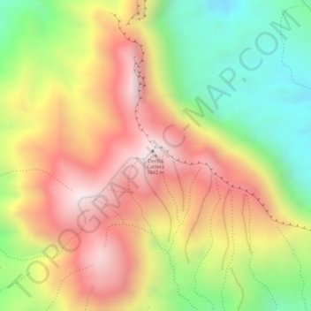
Name: Deriba Caldera topographic map, elevation, terrain.
Location: Deriba Caldera, Zalingei, Central Darfur, Sudan (12.93777 24.23583 12.93787 24.23593)
Average elevation: 8,802 ft
Minimum elevation: 7,559 ft
Maximum elevation: 9,869 ft
Deriba is an oval, 4.8 by 6.4 kilometres (3 mi × 4 mi) wide and 500–1,000 metres (1,600–3,300 ft) deep caldera, with a volcanic cone occupying the southwestern part of the caldera floor. At least five overlapping vents form the volcanic cone. The rim of the caldera reaches a maximum elevation of 3,024 metres (9,921 ft) in the southwest, and is steep almost vertical. The caldera is cut into volcanic ash, lapilli, lavas, obsidian and tuffs, and the floor is strewn with pumice blocks. A gap lies in the eastern caldera wall.