Geolocate

Millbrook topographic map

Click on the map to display elevation.

About this map

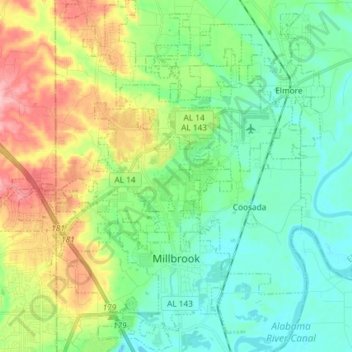
Name: Millbrook topographic map, elevation, terrain.

Location: Millbrook, Elmore County, Alabama, 36054, United States (32.44688 -86.41945 32.57045 -86.33345)

Average elevation: 269 ft

Minimum elevation: 125 ft

Maximum elevation: 591 ft

Other topographic maps

Click on a map to view its topography, its elevation and its terrain.

Five Points

United States > Alabama > Elmore County > Millbrook

Average elevation: 200 ft

Broadmoor

United States > Alabama > Elmore County > Millbrook

Average elevation: 233 ft

Springfield

United States > Alabama > Elmore County > Millbrook

Average elevation: 312 ft

Jordan

United States > Alabama > Elmore County

Average elevation: 568 ft

Wallsboro

United States > Alabama > Elmore County

Average elevation: 240 ft

Governor's Island

United States > Alabama > Elmore County

Average elevation: 538 ft

Weoka Creek

United States > Alabama > Elmore County

Average elevation: 407 ft

Gear up for your next adventure:

🛏️Cold Weather Sleeping Bag - Warm sleeping bag for cold conditions
😴Insulated Sleeping Pads - Compact and warm pads for high-elevation camping
🕶️GPS Smartphone Mount - Secure mount for phone navigation
🔭Compact Binoculars - HD vision for scouting terrain and identifying distant landmarks
🎒Hydration Pack - Hands‑free water reservoir for long hikes

As an Amazon Associate, this site earns from qualifying purchases at no extra cost to you.