
Villamantilla topographic map
Interactive map
Click on the map to display elevation.
About this map
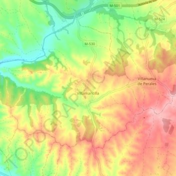
Name: Villamantilla topographic map, elevation, terrain.
Location: Villamantilla, Sierra Oeste, Comunidad de Madrid, Spanje (40.31825 -4.18863 40.36979 -4.10296)
Average elevation: 1,837 ft
Minimum elevation: 1,588 ft
Maximum elevation: 2,080 ft