
Maentwrog topographic map
Interactive map
Click on the map to display elevation.
About this map
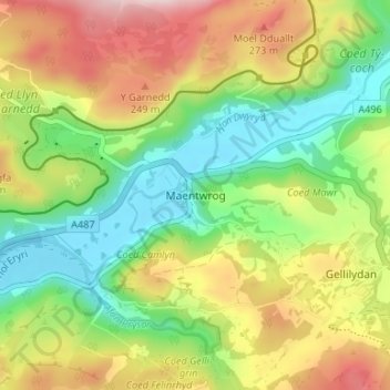
Name: Maentwrog topographic map, elevation, terrain.
Location: Maentwrog, Gwynedd, Wales, LL41 4HN, United Kingdom (52.92577 -4.00732 52.96577 -3.96732)
Average elevation: 443 ft
Minimum elevation: -7 ft
Maximum elevation: 1,063 ft