Geolocate

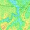
Cibubur topographic map

Click on the map to display elevation.

About this map

Name: Cibubur topographic map, elevation, terrain.

Location: Cibubur, Ciracas, East Jakarta, Special capital Region of Jakarta, Java, 13720, Indonesia (-6.37261 106.86854 -6.33959 106.89589)

Average elevation: 213 ft

Minimum elevation: 157 ft

Maximum elevation: 262 ft

Other topographic maps

Click on a map to view its topography, its elevation and its terrain.

Hutan Kota Munjul

Indonesia > East Jakarta > Munjul

Average elevation: 210 ft

Ciliwung River

Indonesia > East Jakarta

Average elevation: 141 ft

Ciliwung River

Indonesia > East Jakarta

Average elevation: 95 ft

Pulau Aru

Indonesia > East Jakarta

Average elevation: 125 ft

Kali Cipinang

Indonesia > East Jakarta

Average elevation: 194 ft

Ciliwung River

Indonesia > East Jakarta

Average elevation: 95 ft

Ciliwung River

Indonesia > East Jakarta

Average elevation: 95 ft

Gear up for your next adventure:

🌡️Portable Weather Meter - Track weather conditions on the trail
🪶Trail Camera - Capture wildlife on your hikes
🌎3D Topographic Globes - Raised relief globes for a tactile understanding of geography
🛠️Backpacking Tool Kit - Essential toolkit for outdoor repairs
🪶Wildlife Field Guides - Learn animal tracking and species ID

As an Amazon Associate, this site earns from qualifying purchases at no extra cost to you.