
Helpenstein topographic map
Interactive map
Click on the map to display elevation.
About this map
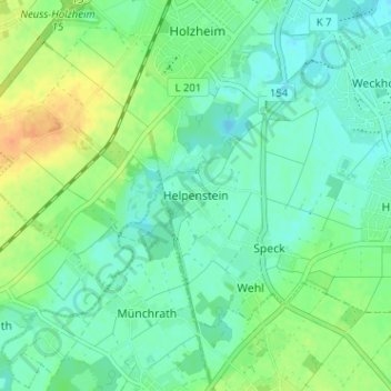
Name: Helpenstein topographic map, elevation, terrain.
Average elevation: 161 ft
Minimum elevation: 125 ft
Maximum elevation: 233 ft
Other topographic maps
Click on a map to view its topography, its elevation and its terrain.
Minkel 2
Duitsland > Noordrijn-Westfalen > Rhein-Kreis Neuss > Neuss > Helpenstein
Minkel 2, Holzheim, Helpenstein, Neuss, Rhein-Kreis Neuss, Noordrijn-Westfalen, 41472, Duitsland
Average elevation: 164 ft