
Parroquia Caucagua topographic map
Interactive map
Click on the map to display elevation.
About this map
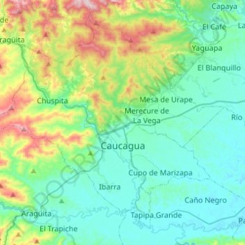
Name: Parroquia Caucagua topographic map, elevation, terrain.
Average elevation: 659 ft
Minimum elevation: 62 ft
Maximum elevation: 2,694 ft
Other topographic maps
Click on a map to view its topography, its elevation and its terrain.
Embalse de Taguaza
Venezuela > Estado Miranda > Municipio Acevedo
Embalse de Taguaza, Parroquia Araguita, Municipio Acevedo, Estado Miranda, Venezuela
Average elevation: 1,099 ft