
Taroko National Park topographic map
Interactive map
Click on the map to display elevation.
About this map
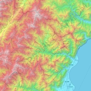
Name: Taroko National Park topographic map, elevation, terrain.
Average elevation: 5,144 ft
Minimum elevation: 0 ft
Maximum elevation: 12,201 ft
Other topographic maps
Click on a map to view its topography, its elevation and its terrain.
Xiulin
Taiwan > Taiwan Province > Hualien County
Xiulin, Hualien County, Taiwan Province, 972, Taiwan
Average elevation: 2,510 ft
Hualien City
Taiwan > Taiwan Province > Hualien County
Hualien City, Hualien County, Taiwan Province, 970, Taiwan
Average elevation: 161 ft
Gui'an
Taiwan > Taiwan Province > Hualien County > Fengbin > Gui'an
Gui'an, Jiqi Village, Fengbin, Hualien County, Taiwan Province, 977, Taiwan
Average elevation: 361 ft