
Nkangala topographic map
Interactive map
Click on the map to display elevation.
About this map
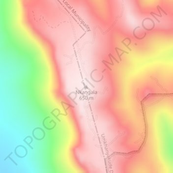
Name: Nkangala topographic map, elevation, terrain.
Average elevation: 1,519 ft
Minimum elevation: 476 ft
Maximum elevation: 2,126 ft
Other topographic maps
Click on a map to view its topography, its elevation and its terrain.
Jozini
South Africa > KwaZulu-Natal > Umkhanyakude District Municipality > Jozini Local Municipality
Jozini, Jozini Local Municipality, Umkhanyakude District Municipality, KwaZulu-Natal, South Africa
Average elevation: 640 ft